Kitgum Airport
Kitgum Airport | |||||||||||
|---|---|---|---|---|---|---|---|---|---|---|---|
| Summary | |||||||||||
| Airport type | Civilian | ||||||||||
| Owner | Kitgum Municipality | ||||||||||
| Serves | Kitgum, Uganda | ||||||||||
| Elevation AMSL | 3,130 ft / 954 m | ||||||||||
| Coordinates | 3°17′00″N 32°53′15″E / 3.28333°N 32.88750°E | ||||||||||
| Map | |||||||||||
| Runways | |||||||||||
| |||||||||||
Kitgum Airport (ICAO: HUKT) is an airport in Uganda. It is one of the 46 airports in the country.[4]
Location
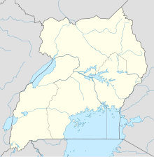
Kitgum Airport is in the town of Kitgum, in Kitgum District, Acholi sub-region, in the Northern Region of Uganda. It lies in the center of town, just west of the Kitgum-Lira Road. It is approximately 363 kilometres (226 mi), by air, north of Entebbe International Airport, Uganda's largest civilian and military airport.[5]
Overview
Kitgum Airport is a small civilian airport that serves the town of Kitgum and the surrounding areas of Kitgum District.
The airport has a single unpaved runway that is full width for 1,500 metres (4,900 ft) with another unobstructed 400 metres (1,300 ft) overrun available on the southern end.[2]
See also
References
- ^ OurAirports, Pilot Information for Kitgum Airport, accessed 15 November 2015
- ^ a b Google Maps - Kitgum
- ^ Airport information for HUKT at Great Circle Mapper.
- ^ "Uganda". CIA World Factbook.
Airports: 46 (2010)
- ^ Flight Distance Between Entebbe Airport And Kitgum Airport With Map


